GIS specialist Mohamed Mohamud Omar argues modern mapping technologies could help Kenya predict and mitigate disasters such as the devastating floods that recently hit parts of the country.
Speaking in a Radio Generation interview on Monday, he explained that geographic information systems (GIS) combine data from satellites, field surveys and other sources to analyse how geographical features interact across space and time.
“Geographic Information Systems collect information from ground data, satellite data, both primary and secondary sources, and combine it to create a map or decision-support tool that informs decisions,” Omar said.
According to Omar, the same technologies are used by meteorological departments worldwide to analyse weather patterns, track climate change and forecast environmental events.
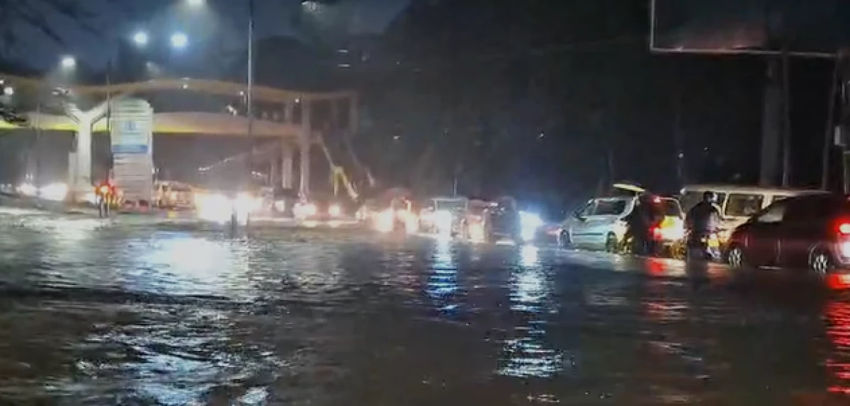
Kenya experienced widespread flooding over the weekend, particularly in Nairobi and Homa Bay, leaving several people dead and others missing after heavy rainfall from Friday through Sunday.
The flooding began on Friday, March 6, 2026, after intense overnight rainfall hit parts of the country, particularly the capital Nairobi and counties around the Lake Victoria basin.
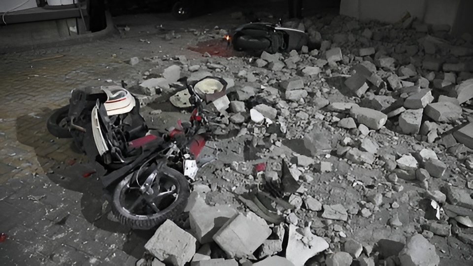
Rivers burst their banks, roads were submerged and vehicles were swept away as water levels rose rapidly in low-lying areas.
According to official reports, at least 42 people have died in the floods nationwide, with Nairobi recording the highest number of casualties.
Several others remain missing while rescue operations continue in affected areas. Thousands of households have also been displaced after homes were destroyed or inundated by floodwaters.
The Kenya Meteorological Department had earlier issued warnings about heavy rainfall before the floods occurred.
In a seasonal advisory released on February 25, the department forecast rainfall exceeding 20 millimetres within 24 hours in several regions and warned that the conditions could trigger flash floods and poor visibility.
Additional alerts later warned of moderate to heavy rainfall between March 4 and March 9 in Nairobi and surrounding counties.
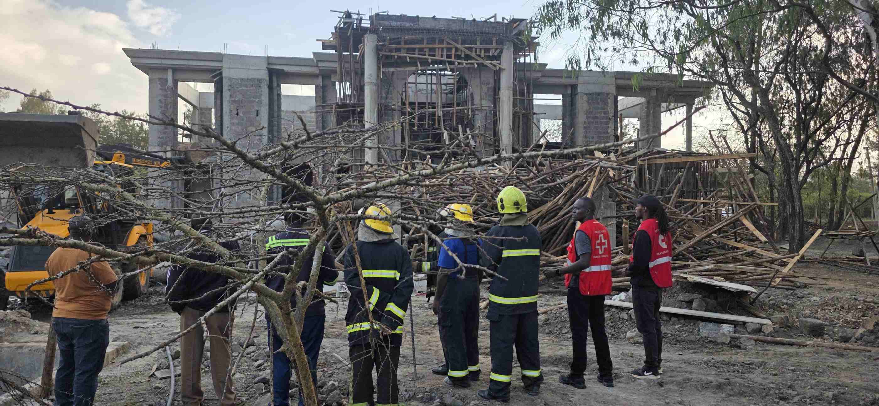
Several government agencies have been mobilised to mitigate the disaster. These include the Ministry of Interior, the National Police Service, the Kenya Defence Forces, and humanitarian agencies such as the Kenya Red Cross Society, which are conducting rescue operations and assisting stranded residents.
The government has also activated a multi-agency emergency response to coordinate rescue efforts and relief distribution.
President William Ruto announced that the state will cover hospital bills and burial expenses for victims, while emergency teams have been deployed to clear blocked drainage systems and relocate residents living in flood-prone areas.
Authorities have urged residents in vulnerable locations to move to higher ground and avoid crossing flooded rivers as heavy rains are expected to continue in some regions.
Omar said disasters are events that disrupt communities to the extent that they cannot cope without outside assistance.
He explained that disaster management is usually divided into five stages, prevention, mitigation, preparedness, response and recovery.
“The first three phases happen before the disaster occurs,” Omar said. “Right now we are in the response phase, which is what happens immediately after a disaster.”
Disasters can be natural or human-made, he added, and natural disasters are further categorised into slow-onset and fast-onset events.
Drought is an example of a slow-onset disaster, which can be difficult to predict, while floods are often fast-onset events.
However, Omar said advances in satellite imagery and weather modelling make it possible to anticipate heavy rainfall patterns days or even months in advance.
“With the current information, with satellite imagery and weather models that predict conditions seven days, a month or even three months ahead, we can mitigate disasters even if we cannot fully prevent them,” he added.
He added that agencies such as the Kenya Meteorological Department and the Kenya Red Cross had issued warnings about the heavy rains that caused the floods.
But he argued that the absence of detailed flood-risk zoning in urban areas contributed to the high number of casualties, particularly in Nairobi.
Flooding occurs when water inundates land that is normally dry, often after rainfall exceeds the capacity of drainage systems or when rivers overflow.
When this happens, water can submerge roads, buildings and other infrastructure.
The GIS specialist said Nairobi’s geographical layout also contributes to flooding.
The city was originally established on relatively high ground during the construction of the railway in the early 20th century.
However, its terrain slopes gradually downward towards the northern and eastern parts of the city. “As water moves, it always flows to the lowest point,” he explained.
“When settlements and infrastructure block these natural pathways, flooding becomes inevitable.”
He pointed to areas such as South B, South C and South D as locations that have historically been prone to flooding.
According to him, some of these neighbourhoods were originally wetlands or swampy areas.
While development in such areas is possible, he warned that problems arise when construction blocks waterways or encroaches on riparian land.
Riparian zones, the land surrounding rivers and streams, are protected areas under environmental laws, typically ranging from 6to 30 metres depending on the size of the river.
“These areas should not be invaded because water has been moving through them for millions of years,” he said.
Omar also blamed increasing urbanisation for worsening floods.
Decades ago, rainfall would soak into the soil or be absorbed by vegetation and wetlands. But rapid urban growth has replaced natural surfaces with roads, buildings and paved compounds.
“When rain falls on these impervious surfaces like asphalt and cabro, it cannot seep into the ground,” he explained.
Instead, the water flows rapidly into drainage systems, overwhelming them. Research suggests runoff from such surfaces can increase water flow by as much as 60%, he said.
Omar also criticised Nairobi’s outdated urban planning framework. He said the city’s master plan was originally developed in 1948 and has not kept pace with rapid population growth and expansion.
“The city has evolved, but planning and implementation have not evolved at the same pace,” he said.
As a result, uncontrolled land use, blocked drainage channels and construction in flood-prone areas continue to expose communities to disaster.
He called for better enforcement of urban planning regulations and wider use of GIS data to guide development and disaster preparedness.