37 Nairobi neighbourhoods identified as high-risk flood areas
According to the Ministry of Interior, the mapping exercise, conducted under the Nairobi Rivers Regeneration Programme, highlights areas at risk along major rivers, including the Nairobi, Mathare, and Ngong rivers.
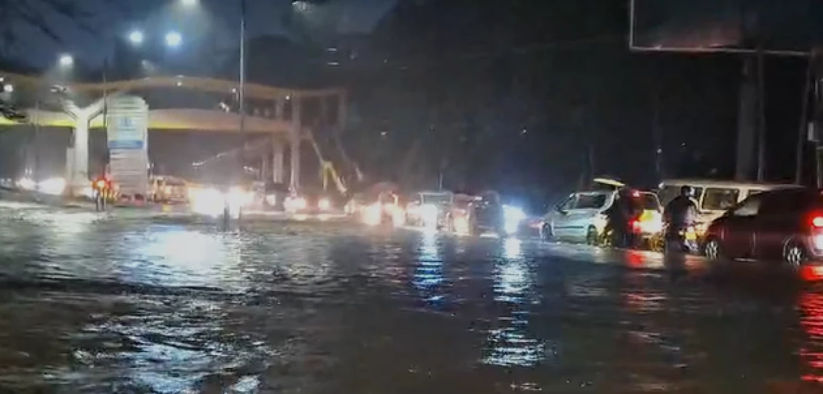
As the heavy rains continue to cause widespread flooding in Nairobi, affecting numerous neighbourhoods and disrupting daily life, thirty-seven neighbourhoods across Nairobi have been identified as highly vulnerable to flooding, spanning the East, West, North, Central, and South river corridors.
According to the Ministry of Interior, the mapping exercise, conducted under the Nairobi Rivers Regeneration Programme, highlights areas at risk along major rivers, including the Nairobi, Mathare, and Ngong rivers.
The initiative aims to inform planning and disaster preparedness while supporting multi-agency coordination for rescue, evacuation, and relief efforts.
In Nairobi East, flood-prone areas include Kiambiu, Dandora, Kariobangi, Kayole, Komarock, Njiru, Ruai, Mwiki, Donholm, Savannah, Tassia, and Fedha, many of which lie downstream along sections of the Nairobi River and its tributaries.
Nairobi West has been flagged for Madaraka, Nairobi West, Lang’ata, Kawangware, Kangemi, Lavington, Westlands, Parklands, Kitisuru, Spring Valley, Kileleshwa, and Chiromo, situated along upstream and midstream sections of the river network.
The North corridor faces risks in Mathare, Korogocho, and Lucky Summer along the Mathare River, where dense settlements closely border the riverbanks.
In Central Nairobi, key locations along the river corridor include the Central Business District (CBD), Globe, Gikomba, Eastleigh, and the Industrial Area.
Nairobi South has Kilimani, Kibera, South C, South B, Mukuru Kwa Reuben, and Kwa Njenga along the Ngong River corridor flagged as flood-prone areas.
According to the Kenya Red Cross, areas including Parklands, the Central Business District (CBD), Ngong Road (Ngando), Lower Kabete, Kibera, Kilimani, South B, Kawangware, Lang’ata, Lavington, Eastleigh, and Riruta on Saturday experienced significant waterlogging as a result of heavy rains.
Both the Nairobi and Ngong rivers overflowed, resulting in riverine flooding, while major roads such as the Expressway (Museum Hill exit), Limuru Road, Bunyala Road, and Lusaka Road reported severe traffic disruptions.
Red Cross Aqua Rescue teams were deployed, rescuing 11 people from a stranded matatu along Bunyala Road and two children from a flooded home in Kilimani.
President William Ruto has assured citizens that the government is fully mobilised, with multi-agency teams conducting rescue and evacuation operations, clearing blocked drains, and delivering emergency food and medical supplies.
In a statement on Sunday, he urged residents to follow advisories from the Kenya Meteorological Department and police for their safety.
“Adherence to them will help us protect lives during this challenging period,” Ruto said.
Authorities emphasized the importance of vigilance. “Residents living near riparian and low-lying areas are urged to remain vigilant and prioritize their safety during periods of heavy rainfall,” authorities noted.
With heavy rains continuing across the country, the government and emergency agencies are intensifying measures to protect lives, restore access routes, and mitigate flood-related damages in the city.


Comments
Sign in with Google to comment, reply, and like comments.
Continue with Google