
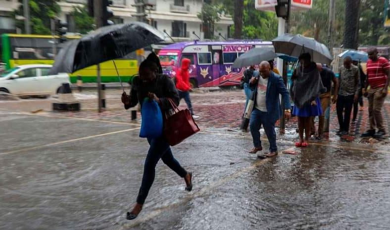
County governments across the country are rushing to prepare for the expected heavy October-December rains, with authorities clearing drainage channels, mapping flood and landslide hotspots, preparing evacuation centres and setting aside millions of shillings for emergency response.
However, preparations are at different stages, with some counties already deploying machinery and organising rescue teams while others still face serious gaps in drainage and other infrastructure in areas that have suffered repeated flooding.
In Nyando, residents of flood-prone Konim village have formed a disaster and risk management group to help protect the community from the expected rains.
The group plans to clear blocked trenches, culverts and drainage channels, remove silt from waterways and build dykes to stop River Nyando from spilling into the village.
About 1,500 people live in the area, which has repeatedly experienced floods that destroy houses, disrupt livelihoods and force families to move to temporary shelters.
A multi-agency team assessing areas at risk of flooding has identified an exit route through which River Nyando water reaches surrounding communities.
National Water Harvesting and Storage Authority chief executive Julius Mugun said engineers planned to close the route, a move that could address up to 80 per cent of the flooding problem in Nyando.
The authority also plans to inspect existing dykes, protect sections of riverbank affected by erosion and remove silt from the river channel beneath Nyando Bridge.
A long-term plan to construct the Soin-Koru Dam is still dependent on funding.
Nyando Deputy County Commissioner Elijah Maranga said about 10 evacuation centres had been prepared. The centres have been stocked with food, non-food items, medical supplies, mosquito nets and drugs for treating waterborne diseases.
In Trans Nzoia, however, the level of preparation remains mixed.
A spot check found that there was no ongoing work to repair damaged drainage systems in Kitale. Residents of Namanjalala have also raised concerns over years of flooding, saying more than 700 acres of farmland along a river have been affected.
Officials said emergency committees had been activated as the county prepares for possible floods and landslides.
Kenya Red Cross coordinator Ruth Miningwo said flood and landslide risk areas had been mapped across all five sub-counties. The identified areas include sections along River Sabwani as well as areas around the Amani and Kaptega dams.
Volunteers are being trained in first aid, while drivers are being prepared to take part in search-and-rescue operations if emergencies occur.
In Turkana, authorities are preparing for increased water flows from neighbouring counties and countries. Meteorological officials have warned that some parts of the county could begin receiving rain as early as September.
Schools in Turkana East have been identified as part of the preparedness plan, with parents expected to be mobilised around evacuation arrangements and safe areas.
The county also plans to drill five boreholes in Kanamkemer and Township wards to protect water supplies in case floods damage existing infrastructure.
Residents, however, continue to raise concerns about drainage.
In California, Lodwar, Ekaran said roads had been improved but drainage remained a problem because water was not being properly channelled into seasonal River Kawalase. This has left stagnant water around homes.
The county is also seeking to establish a command and coordination centre that would support real-time sharing of information during emergencies.
In Uasin Gishu, heavy machinery has been deployed to flood-prone parts of Kapseret, Kesses and Turbo to clear waterways, open drainage routes and remove silt from culverts.
The county is also putting in place evacuation procedures and safety centres for communities that may be affected.
Nyeri has set aside Sh20 million for emergency response as it prepares for possible flooding and landslides.
Schools in landslide-prone Mukurweini and Tetu will be used as evacuation centres, while drainage systems in flood-prone parts of Mathira and Kieni are being improved.
The county plans to use the Nyumba Kumi network to issue early warnings to residents and has provided the toll-free emergency number 1549.
Each sub-county has an ambulance, while St John Ambulance and the Kenya Red Cross will support emergency response efforts.
In Embu, authorities have established a disaster preparedness committee to coordinate preparations.
Murang'a, despite being classified as highly vulnerable to landslides and mudslides, still has major preparedness gaps.
In Maragua, an open sewer remains blocked, while feeder roads without drainage in Kahumbu leave homes exposed to stormwater.
The county has allocated Sh27.7 million for disaster management and social welfare in its Sh12.5 billion 2026/27 budget.
Youth Service teams have been deployed to clear drainage channels in major towns as part of the preparations.
In Meru, quarries in Imenti South and Imenti Central, together with areas near the Nyambene Ranges, have been identified as landslide hotspots.
Maua has also been classified as an area at risk of flooding.
Meru has allocated Sh29 million for emergencies in the 2026/27 financial year, although no funds have been set aside for emergency relief in the current financial year.
In Bomet, authorities have mapped flood-prone areas in Chepalungu, Sotik and the lower parts of Bomet East.
Residents are being sensitised on the need to keep away from riverbanks and other areas at risk of flooding. Officials are also preparing for possible outbreaks of malaria and waterborne diseases.
In Kericho, Kipkelion East and Kipkelion West have been identified as areas vulnerable to mudslides.
Municipal boards are clearing stormwater drains, while residents are being advised to move to higher ground when heavy rains threaten their areas.
In Narok, flood-prone parts of Narok South and Narok West have benefited from stormwater drainage works and raised footpaths.
Nakuru officials have warned that rising water levels in Lakes Nakuru and Naivasha could threaten settlements around the lakes.
Heavy rainfall could also lead to soil erosion and the loss of farmland, while flooding could contaminate water sources and increase cases of waterborne diseases.
A toll-free line has been established for residents to report emergencies.
In Kwale, authorities have identified Kiwegu, Perani, Jasini and Majoreni in Lungalunga, Diani and Ukunda in Msambweni, and parts of Matuga and Kinango as vulnerable areas.
Authorities are working with village elders to improve early warning systems and have identified social halls, churches and mosques that can be used as evacuation centres in Vanga, Diani-Ukunda and Shimoni.
In Mombasa, a multi-agency team bringing together the Kenya Navy, police and county government is preparing ambulances, fire engines and rescue centres.
However, a spot check found that drain-clearing work had not yet started.
The county plans to hire youths to undertake the work and has allocated Sh20 million to its Emergency Fund Services for the 2026/27 financial year.
In Tana River, the county government and partners, including the Kenya Red Cross, Concern Worldwide and Welthungerhilfe, have prepared sector-specific advisories covering preparedness, safety and early action.
The advisories will be shared through radio, public barazas, community structures and digital platforms.
Kilifi has prepared an El Niño Contingency Plan outlining measures to be taken before, during and after the rains.
The Kenya Red Cross and other organisations will support response and recovery efforts under the plan.
In Lamu, authorities have also set aside resources as part of preparations for the rains.
Vulnerable areas include parts of Witu, Mkunumbi, Hongwe, Hindi, Kiunga and Basuba.
Early warning messages are being shared through local radio stations, while voluntary evacuation of residents living in flood-prone areas is expected to begin next week.